Teknisk uppgradering av Naturkartan måndag morgon

På måndag morgon driftsätter vi en stor teknisk uppgradering av Naturkartan som vi arbetat med i 18 månader. Uppgraderingen ger en snabbare och mer stabil plattform och lägger grunden för de nya funktioner som kommer i Naturkartan version 3 under hösten. Det kan förekomma kortare driftstörningar under början av veckan men vi gör vårt bästa för att lösa alla problem som uppstår. Hjälp oss gärna genom att tipsa oss på emil@outdoormap.com - om något inte fungerar som det skall!

Hiking

Renholmens kulturstig

Hiking

0 van 5 sterren — (zie beoordelingen)

Pad details

  • Lengte 1.0 km

Acties

Omschrijving

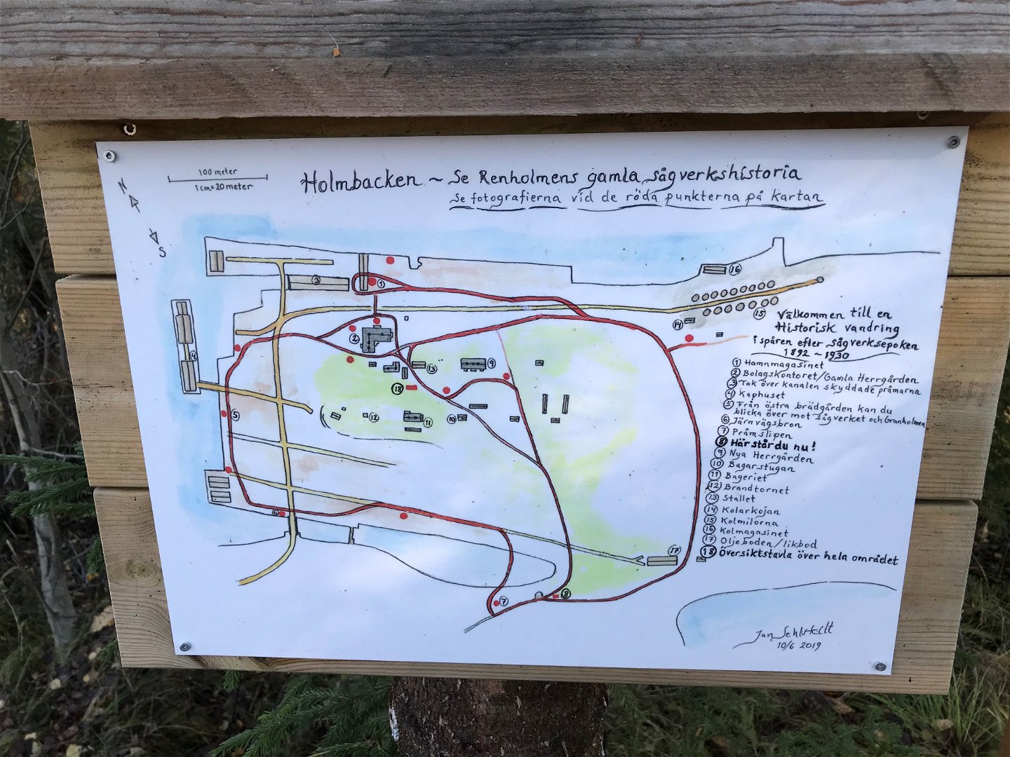
From the old quay on Renholmen, you look out over the estuary of the river, which once housed steamboats and sailing ships with sailors from all corners of the world. You follow the signs and walk up to the place where the Company Office once stood.

Met het openbaar vervoer

Activiteiten en faciliteiten

  • Hiking Hiking

Feiten

Along the trail you will find local history, events and places described on information boards.

Oppervlakte

forest path, bark,

Heuvels

slightly hilly

Parkeren

at Renholmens parking lot, located 15 km northeast of Byske.

Routebeschrijving

You start the hike at Renholmens Ställplats, which is located 15 km northeast of Byske. The parking lot is located east of Renholmen village at the mouth of the Åby River.

Contact

E-mailadres

Kundtjänst Skellefteå kommun

+46 910 73 50 00

kundtjanst@skelleftea.se

Houd er rekening mee dat sommige teksten automatisch zijn vertaald.

Vragen en antwoorden

Stel een vraag aan andere Naturkartan gebruikers.

Beoordelingen

Naturkartan

Naturkartan

Open dit in de app