-

-

Kuva: Carola Mann

Västerplana storäng, Naturreservat
Luonnonsuojelualue
- Kunta: Västra Götalands län
- 6641.53 km päässä sinusta
Toiminnot
Kuvaus
In the Västerplana storäng nature reserve you will find steep cliffs, lush deciduous forest, grazed pastures and traces of the Bronze Age inhabitants of Kinnekulle.
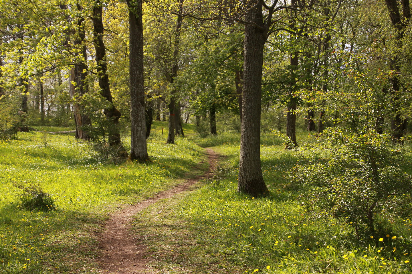
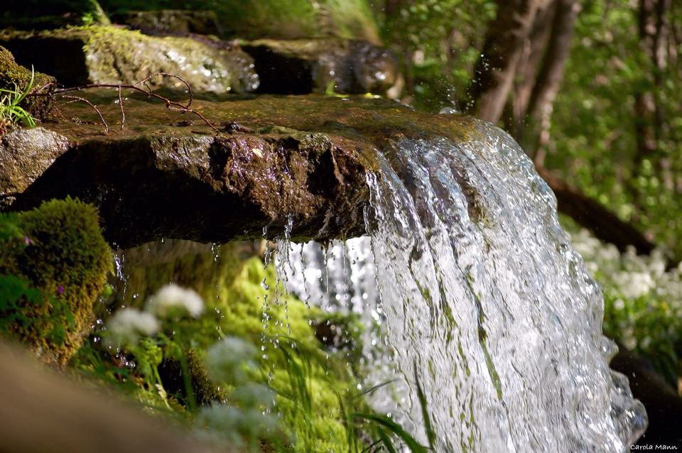
The Västerplana Storäng nature reserve stretches just over five kilometers along the southwest side of Kinnekulle. A large part of the stretch is the 20 meter high sandstone cliff that plunges towards Lake Vänern. A lush but inaccessible deciduous forest with rich bird life and most of our deciduous trees grows on the slope. Several streams form small waterfalls over the cliff. A detour from the Kinnekulle hiking trail, which runs through the southern part of the nature reserve, leads to a viewpoint on the cliff.
Grazed pasture and spring wild garlic
Above the precipice, the ground is flatter with a grazed pasture with old deciduous trees. Oak is the most common tree, but there are also many lime trees. The area is perhaps at its most beautiful in early summer, when the ground is covered with the snow-white flower balls of wild garlic.
In the area, a trained eye can see traces of a very old history of agricultural hardship in the form of stone walls, cairns and terraces. The remains are traces of ancient Kinnekullebors cultivations that are 2,000 to 3,000 years old.
The name Västerplana storäng comes from the very large hay meadow that once existed between Lake Vänern and Västerplana village. The meadow was vividly described by Carl Linnaeus during his visit to Kinnekulle in 1746. The nature reserve is one of the few parts of the former meadow that was not converted into fields in the 20th century.
Outdoor life
The Kinnekulle hiking trail passes through the southern part of the nature reserve. Take a detour from the trail to enjoy the view of Lake Vänern from the steep sandstone cliff.
In spring you can enjoy the flowering wild garlic, but remember that it is forbidden to pick wild garlic within the nature reserve.
You can also choose to hike the Blombergsleden, a four-kilometer circular trail, which takes you through beautiful and varied natural environments along the shores of Lake Vänern. From the trail you also have a view into the pastures of the nearby Blomberg Nature Reserve. Along the trail you will find Blomberg harbor where you can see the Viking ship Sigrid Storråda. You also pass Blomberg's bathing area. Here you can choose whether you want to swim from the sandy beach, the rocks or from the jetty. There is also a barbecue area and toilet at the bathing area.
Toimintaa ja tilat
-
Luonnonsuojelualue
Faktat
Founded: 2002
Area: about 95 hectares
Nature conservation manager: County Administrative Board in Västra Götaland County, (Länsstyrelsen i Västra Götaland.)
Municipality: Götene
Västerplana storäng is part of the EU's network of protected areas, Natura 2000, and is formed with partial funding from the EU fund LIFE-nature.
Reittiohjeet
Västerplana storäng is located on the southwestern part of Kinnekulle.
On foot:
You can follow the Kinnekulle hiking trail that runs through the southern part of the reserve.
By public transport:
The nature reserve can be reached by the Kinnekulle train from Blomberg station with a 2.5 km hike on the Kinnekulle trail.
By car:
A parking lot is located along the road between Hjelmsäter and Blomberg. From there you have to walk 400 meters.
Asetukset
For visitors to the area
You are welcome to visit the Västerplana storäng nature reserve, but please note that it is not permitted to
- drive a motorized vehicle
- cycle or ride a horse
- camping or setting up a caravan or motorhome
- make a fire
- damage dead lying or standing trees
- trapping or collecting invertebrates
- break, smash or remove stones from the reserve
- organize camps, set up orienteering controls or mark out trails
- picking or digging up grasses, herbs, mosses, lichens or fungi. However, picking berries and edible mushrooms is allowed.
Ota yhteyttä
Sähköpostiosoite
Huomaa, että osa näistä teksteistä on käännetty automaattisesti.
Kysymykset & vastaukset (Q&A)
Esitä kysymys muille Naturkartan-käyttäjille.
